Learn how to use the powerful photogrammetry software DJI Terra from DJI and get started with 3D modeling! We show you how to create survey grade point clouds, orthophotos, terrain models and textured 3D models with your DJI drone.
DJI Terra is a software solution from DJI which combines flight planning and photogrammetric data analysis. The software features fast processing speed, high quality 2D & 3D reconstructions and a simple user interface.
We have used DJI Terra since the first release in 2019 in a wide variety of surveying projects. As the largest provider of photogrammetry services and trainings in Germany, we are happy to share our experiences, best practices and workflows in drone surveying. Our certified photogrammetry experts teach you the complete workflow from data acquisition to processing to the finished product.
DJI Terra
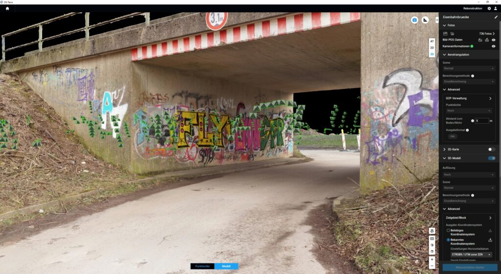
DJI Terra was developed by DJI Innovations for enterprise and business customers. The software is a flight planning, mapping and aerial survey solution – flights can be planned, data can be collected, areas can be mapped and the data can then be analyzed. As such, DJI Terra allows for the rapid digitization of the environment and can therefore be used in surveying, construction, real estate, agriculture or infrastructure project mapping. In addition, the software can be used with the L1 laser scanner and DJI’s multispectral solutions. Advantages of the software compared to other photogrammetry solutions are the simple user interface and the processing speed – the data quality is on a similar level to the photogrammetry solutions on the market. The only disadvantage is the lack of options for post-processing the reconstructed data products.
DJI Terra includes two main components: Flight Planning and data evaluation.
Flight Planning:
Create efficient flight routes with predefined actions at each waypoint. Key functions such as speed, altitude and gimbal orientation can be set before the flight. For more complex flight missions and flights in confined conditions that require a very high level of detail, 3D flight visualization is now available to plan and simulate flights in existing 3D models.
Photogrammetric Evaluation:
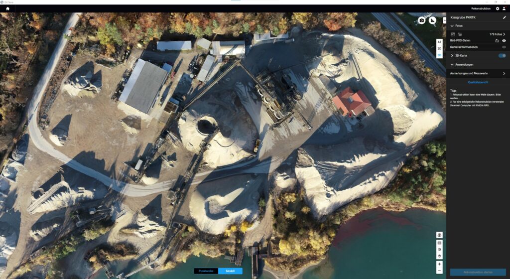
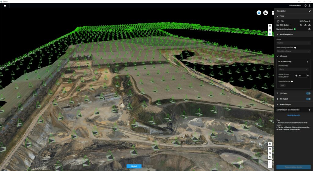
You can use DJI Terra to create 2D orthophotos as well as high-resolution point clouds and 3D models. In addition, multispectral data (P4MS, M3MS) as well as raw LiDAR data (L1) can be processed. It is a complete solution that offers unprecedented efficiency to industrial users, with comprehensive reconstruction models for industries such as land mapping, energy transmission, emergency services, construction, transportation and agriculture.
Process LIDAR Data (L1)
Process point cloud data in DJI Terra that was acquired with the Zenmuse L1. Calculate POS data, merge point cloud and RGB data, export point clouds in standard formats, and create mission reports with just one click.
Analyze multispectral data (P4 MS, M3MS)
Generate radiometrically calibrated reflectance maps using P4 Multispectral data for remote sensing exploration and more, or create vegetation index maps including NDVI and NDRE that provide insights into crop health and help make important management decisions.
For more info on DJI Terra, click here.